
Exact date Storm Nelson to batter Brits with 641-mile wall of rain and strong winds ahead of Easter weekend
27 March 2024, 11:50


Brits are set to be battered with heavy rain and strong winds brought by Storm Nelson this week.
Listen to this article
Loading audio...
The weather has been unsettled in the UK so far in March, and the wet and windy conditions are forecast to continue over the rest of the month.
Storm Nelson is coming in from Spain, where it was named by Spanish forecasters Aemet, and is due to arrive in the UK overnight on Wednesday and on Thursday.
It has not been named by the Met Office. The last storm named in the UK was Jocelyn, on January 2022.
Spanish forecasters said: "Storm Nelson, recently named by Aemet, will give rise in the coming days to strong gusts of wind and rain in large areas of the territory in a period of great social relevance such as Holy Week."
Read more: Easter weekend washout: UK braced for heavy rain and high winds ahead of bank holiday
Read more: Heavy downpours to sweep UK as new weather maps show incoming wall of rain

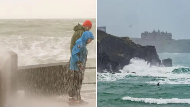
A band of rain measuring over 600 miles long is set to hit the UK from the west overnight on Wednesday.
A yellow weather warning was in place on Wednesday for Belfast in Northern Ireland, with 2.8 inches of rain expected to fall.
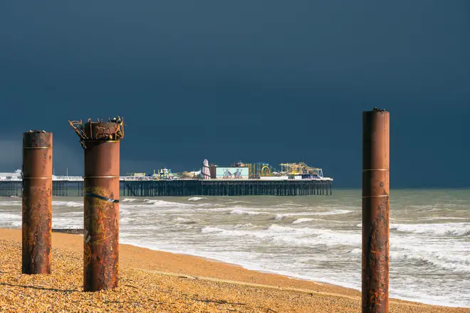
On Thursday, the Met Office has issued a yellow warning for wind for most of the south coast of England, stretching from Brighton in the east to Land's End in the West, covering most of Cornwall.
Forecasters said that strong winds and large coastal waves could cause dangerous conditions.
The Met Office's UK forecast for Thursday suggests that were "some bright spells, especially across Scotland at first."

He added: "However, showery rain moving north across most areas during the day. Some hail and thunder in the south, where also very windy."
Met Office deputy chief meteorologist Helen Caughey said: "It's another very unsettled week for much of the UK, with heavy, blustery showers, longer spells of rain and also some strong winds.
"In terms of hazards in the current forecast, we're continuing to keep an eye on some of the expected rainfall totals as they build up through the week, with some places, including Northern Ireland, still quite sensitive to rainfall amounts due to the wet winter many have experienced.
"We will also need to monitor the winds with the potential for gales to develop around some coastal areas of the north at first, then later for some south and southwestern areas, especially as these may coincide with some high tides."
She added: "Showers will continue into the weekend, especially for southern and western areas.'However, it is likely that we will see something of an improvement for most areas, with showers tending to become less frequent, and a better chance of longer spells of sunshine for eastern and northern areas in particular.
"It will also become less windy, and temperatures should start to trend upwards, feeling quite warm in any sunshine.
"However, more widely unsettled conditions look likely to return into Easter Monday, but there is still some uncertainty in the timing of this deterioration."